Weather-related topics, events, & forecasts...

Thursday, February 1, 2024

ATMOSPHERIC RIVER IMPACTS WEST-USA: PART I OF II

Atmospheric River Brings Abundant Precipitation to West-USA in Two Waves:

A weather pattern shift has begun for much of the western portions of the US. After a period of mild and predominantly dry conditions in late January, the onset of an Atmospheric River (AR) event has started working its way into the Desert Southwest (and many of the western states). This is the first of two waves of which stem from the moisture of the tropics.

Below is a loop of the visible satellite channel observed on Thursday, 01 February, 2024. Note the low pressure center off the coast of Washington state. This area of low pressure was a driving factor in drawing up the first wave of the AR. Wave number one of the AR is located over the Desert Southwest (Baja California and southern California). The moisture is being advected northward throughout the western states. Wave number two of AR moisture is beginning to develop northeast of Hawaii - this will arrive over the contiguous US late this weekend into early next week.


The modeled precipitable water by the GFS (showing older 00Z run to see the entire setup) is depicted below. This is a way to track "moisture" that the atmosphere is transporting. AR wave number one is at the very beginning of the loop along the California-Mexico coastline, followed by AR wave number two near the latter part of the loop.


Translating this to a more applicable parameter, below is the modeled (simulated) RADAR reflectivity for the Southwest US region. For the first AR wave, the strongest rainfall rates are likely to occur over the Desert Southwest of southern California/Nevada/Utah and Arizona Thursday through Friday night. Lighter precipitation rates are likely elsewhere. With the flow out of the southwest, moderately warm air is expected to advect over the region. Consequently, the higher freezing level will mean mountain snow and valley rain for most areas. Snow levels may begin to creep down to some valley floors after sundown on Friday in areas such as northern Utah and Idaho.


The Quantitative Precipitation Forecast (QPF), or expected liquid water that is expected to accumulate, suggests some significant values for parts of the western US. For an area of the country that is quite a barren desert, these numbers are significant.

The 72-hour QPF for Thursday (01 Nov) through Saturday night (the window for AR wave number one) is depicted below:


The 48-hour QPF for Sunday night (04 Nov) through Tuesday night (the window for much of the first half of AR wave number two) is depicted below:


The 48-hour QPF for Tuesday night (06 Nov) through Thursday night (the window for much of the second half of AR wave number two) is depicted below:


For the full, two AR events, here is the 7-day QPF for Thursday night (01 Nov) through the next seven days illustrated below:


With the flow out of the west and southwest, California's coastal areas and high terrain are expected to see the greatest precipitation amounts with QPF values exceeding 4" in seven days across the coast and Sierra Nevada. Maximum QPF values over the higher terrain north of Santa Barbara, California may reach 10-15"!

Perhaps this weather pattern will continue beyond the next week. The Climate Prediction Center predicts lower than normal temperatures with high probability for greater than normal precipitation for 07-11 February.


Credits:

Satellite and Model Data: College of DuPage Weather Center

Quantitative Precipitation Forecasts: Weather Prediction Center QPF 


Sunday, December 31, 2023

Winter Has Been Hibernating. Colder, Snowy Weather for Utah is Likely in January.

As we come to the close of the first full month of Meteorological Winter, and the end of 2023, many folks in Utah are wondering, "where is the snow?" In fact, much of the United States has seen near or above normal temperatures. Many areas, especially along the east and west coasts, have experienced flooding rains. Perhaps a bit of this is due to the current El Nino status of the Pacific Ocean. Nevertheless, winter's early hibernation for Utah, and the majority of North America, is likely to end. There are signs of a weather pattern shift of the jet stream on some long-range, global numerical weather prediction (NWP) models

The jet stream is the driving force and steering mechanism for winter weather in the midlatitudes (i.e. where Utah is located - along the 40°N latitude line). There are a few key elements to understand about the jet stream. As excess energy over equatorial regions gets transported poleward (in the northern hemisphere, that would be from south to north), temperature and pressure gradients become stronger. Areas of higher and lower pressure become more pronounced. High and low pressure "systems" are what steer the jet stream. These strong winds at high altitude are the jet stream and are the result of existing thermal and pressure gradients. The jet stream is a driver of, and is co-located with, storm tracks.

For a good portion of December 2023, the jet stream pattern has been what we in the meteorology world call "zonal flow." Zonal flow is west to east without much poleward motion. If a jet stream exhibits a more flat or zonal flow, it's lacking the key element of energy, heat, and moisture transport that is needed for "active weather." The result: moderated, milder conditions.

The earth's atmosphere is in a constant state of imbalance, but during brief periods of (sometimes on the order of days or weeks) zonal flow can inhibit the transport of equatorial air to the north and subsequent arctic air to the south (also known as cold fronts and digging troughs). As previously mentioned, the recent weather pattern of the jet stream has been zonal. Below is a quick example of a 2-day loop from the GFS model over the eastern half of the Pacific Ocean (North America is faintly visible over the right third of the GIF, Alaska is near the top center). The loop depicts a previous forecast of jet-level wind speed (knots) and direction at the 250mb pressure level (or approximately 36,000 ft MSL) for December 29-30, 2023.


Note how the jet stream flow is predominantly west to east, with jet maximums consistently in the 120-160 knot range. Zonal flow has been a fairly persistent pattern for the majority of December, where only brief and weak ridging or troughing depart the mean flow. In contrast, see the following model loop.


The above GIF is a longer, 7-day loop, for Jan 04-11, 2023. Note how the zonal flow erodes and more of the typical north-south motion of the jet stream ensues? This GFS model solution suggests a potential turning point into a more active weather pattern. These jet streaks are not only ridging and troughing, but are maintaining the wind magnitude more efficiently than what was observed in December.

But hold on! Before we start getting out the ink pens and write up a forecast, we must realize that this is just one model and one model run's solution - not to mention that the certainty and confidence in the model's solution decreases the further out one looks.

However, upon monitoring the model solutions for a couple of days now (the GFS releases a new model run every six hours), there does appear to be increasing confidence in a degradation of the zonal flow (at least over the far eastern Pacific and North America). The placement of the jet, cold air aloft, and ultimately, areas of precipitation have not been incredibly consistent. It is especially difficult to pinpoint the location, timing, and magnitude of snowfall, for example, beyond 3-5 days out (in most scenarios).

With a caveat and a word of caution, several weather forecast parameters will follow below for your viewing pleasure. But it is important to note that these are simply a "snapshot" of singular models' runs and ensembles and do not represent an official forecast. A great source for official forecasts includes: National Weather Service - Salt Lake City Weather Forecast Office

To switch gears from the graphical model view to data box plots, here is a snapshot of an ensemble from National Blend of Models (NBM) 1D Viewer. An ensemble shows either a group of models or their members and displays the range between them (where lower spread of data can be indicative of higher confidence in that weather parameter's forecast). Below arre the predicted range of daily maximum and minimum temperatures at KSLC over the next 10 days. Note the gradual temperature trend is decreasing with time. By the start of week two in January, maximum daytime temperatures may fall and remain below freezing, with nighttime lows in the teens on January 08-10, 2024. The take home is that a decrease in temperature at KSLC is possible, perhaps likely, in early January.

Also from the NBM 1D Viewer, precipitation at KSLC looks most probable after Friday, January 05, 2024. The chances for snow (under precipitation type) remain greater than rain or freezing rain and coincides with the timing of greater accumulated precipitation rates over next weekend. Given the falling temperatures, it seems safe to bet on snowfall with this setup. But we won't delve much further on precipitation at this time due to the uncertainty of the placement of incoming troughs that far out in time.

While this was not an exhaustive nor in-depth look at the forecast process, it's enough to show that there is potential for a weather pattern shift in early to mid-January. At a glance, things look favorable for lowering temperatures and increased precipitation (snow) for Utah and the region.

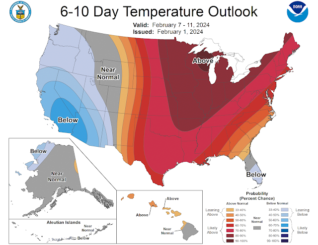
Here is a quick glance at the Climate Prediction Center's 8-14 Day Temperature and Precipitation Outlook, valid January 08-14, 2024:


To get an idea of the early potential for mountain snowfall totals on the Wasatch (at Alta), here is the NAEFS guidance. The lower-left chart shows the various model members for accumulated snowfall at Alta. There is plenty of spread (so certainty is lower at this time). But watching the mean (average in the red line) increasing to approximately 20 inches by Saturday evening (January 06) is promising. 


That's all for now folks. You can always reach out to me with any questions or comments using the comments link near the bottom.

-theWeatherMatt


Credits: 

wolf snow image (royalty free): Pixabay Royalty Free Photos

GFS model GIF loops: College of DuPage Weather Center (Models)

NBM 1D Viewer images: ESRL NOAA - NBM 1D Viewer

Temperature/Precipitation Outlooks: CPC NOAA - Temperature and Precipitation Outlook

Alta Accumulated Snowfall Plumes: University of Utah Weather Center

Thursday, November 30, 2023

Snow set to arrive in Utah, ushering in the first day of Meteorological Winter

Several waves of moisture are setting up to bring snow across the Intermountain West region. An upper-level trough moves over the western United States on Thursday, pushing out that pesky ridge of high pressure. Unfortunately, the trough is broad and multi-faceted with a few shortwaves. As a result, mid-level cold air advection (CAA) is only weak to moderate. It lacks a strong pressure and thermal gradient, meaning winds may not be as strong as one would hope for - nor will the vertical temperature profile be unstable enough - to scour out valley temperature inversions over Utah and the Intermountain West (at least not at first). With temperatures at the 700mb level (roughly 10,000ft MSL) hovering around -7 °C to -8 °C on Thursday, and Jet-level winds well south of Utah, don't expect much improvement with the air quality in Salt Lake City until perhaps Friday (at the earliest).

In fact, due to the somewhat disorganized nature of the synoptics, current model guidance shows the earliest shot at stronger surface winds not occurring until late Friday night. The onset of these strong winds are illustrated below:

Surface Wind Gusts (knots) at 07Z (midnight MST) Sat 02 Dec 2023 [12Z 30 Nov Run]
Credit: College of DuPage Meteorology Program NeXT Generation Weather Lab


The first couple waves of moisture, however, will bring snow showers as early as Friday morning and afternoon. Perhaps Friday's cooler air at the upper levels will help lift the inversion. If not by the afternoon then most likely by the aforementioned winds Friday evening.

Snowfall forecasts still vary somewhat by model. Clusters of GEFS members are hinting at higher snowfall rates Friday afternoon (approximately 2" at SLC Int'l Airport), whereas others follow the trend of gradual snow accumulation over the course of the weekend. The GEFS, NAEFS, and CMCE averages are now in good agreement for snow amounts totaling near 3" at KSLC. But note that despite the precision of the means, there is still some uncertainty on the accuracy due to the spread and lingering outliers on both the high and low ends for KSLC. See the snow plumes for KSLC below. Note that the time on the x-axis is UTC (so subtract 7 hours for MST).

NAEFS Snow Plumes for Salt Lake City (KSLC) 00Z 30 Nov 2023 Model Run
Credit: University of Utah - Department of Atmospheric Sciences Weather Center

High elevations of Utah look to be the winner with this weekend's storms. Heavy mountain snow is expected. Totals ranging 2-5ft this weekend are not out of the question. Specifically for Alta, the GEFS mean is being the most optimistic at 55" when all is said and done. See the snow plumes for Alta ski area below. Times are UTC (subtract 7 hours for MST).

NAEFS Snow Plumes for Alta Collins (CLN) 12Z 30 Nov 2023 Model Run
Credit: University of Utah - Department of Atmospheric Sciences Weather Center

One final thought, any lake enhancement (i.e. "lake effect") snow is likely to occur once the coldest air aloft arrives on Friday evening into Saturday morning. Winds aren't very favorable (by direction) due to the more westerly track crossing over the shorter fetch of Great Salt Lake. Areas that may be impacted by lake-enhanced snowfall include Davis and Weber counties.

The local NWS office has provided the following graphical snowfall forecasts. First is the expected (50th percentile), followed by the high-end (90th percentile) amounts.

Expected (50th percentile) Snowfall Forecast: Fri AM - Mon AM (Dec 01-04)
Credit: Salt Lake City National Weather Service Weather Forecast Office


High-End (90th percentile) Snowfall Forecast: Fri AM - Mon AM (Dec 01-04)
Credit: Salt Lake City National Weather Service Weather Forecast Office


ATMOSPHERIC RIVER IMPACTS WEST-USA: PART I OF II

Atmospheric River Brings Abundant Precipitation to West-USA in Two Waves: A weather pattern shift has begun for much of the western portions...